

Agricultural Mapping & Analysis
We turn hectares of data into smart decisions. Using RGB, multispectral and LiDAR‑equipped drones, Service Drones delivers high‑resolution maps that reveal crop health, soil composition and field topography.
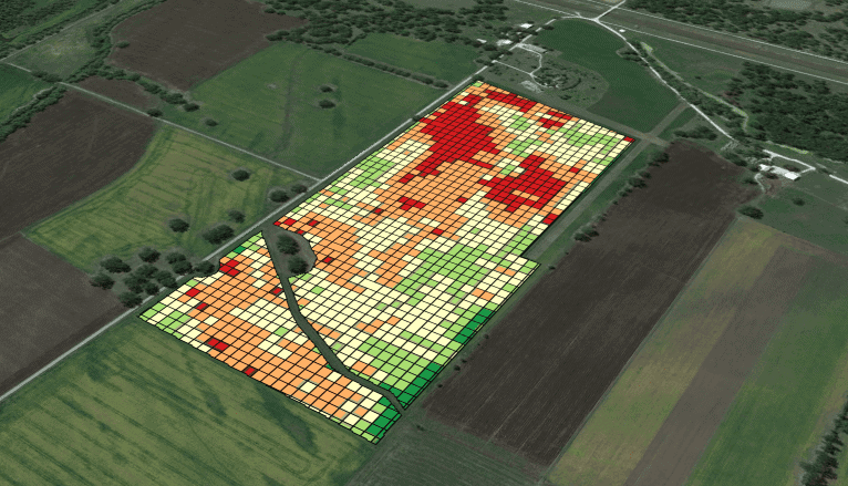
How it works
Key Applications
Crop‑health monitoring
Soil and moisture analysis
Variable‑rate application maps (precision agriculture)
Irrigation and drainage management
Yield estimation and harvest planning
3D topographic mapping
Livestock monitoring (location & condition)
Benefits & Impact
Measurable improvements for your agricultural operations
| Benefit | Impact |
|---|---|
| Greater Efficiency | Swift coverage of large areas — less time and labour required for comprehensive field analysis |
| Enhanced Accuracy | High‑resolution data for better decisions and more precise agricultural interventions |
| Cost Reduction | Optimised inputs and targeted interventions reduce overall operational expenses |
| Environmental Sustainability | Precise input use minimises environmental impact and promotes sustainable farming practices |
| Early Issue Detection | Diseases or nutrient stress spotted before yield loss, enabling proactive management |