
The agricultural industry now experiences a technological shift because drone mapping technology leads this change. Drone technology, which used to exist in science fiction, now serves as an essential tool for farmers who use data to optimize their operations and boost production while minimizing waste and enhancing environmental sustainability.
The implementation of drone mapping technology has revolutionized agricultural practices by transforming the way professionals conduct crop management and soil analysis, and land evaluation.
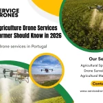
Many farmers in Portugal’s agricultural sector are adopting drone technology and transforming farming operations while enabling local growers to succeed in worldwide markets.
This blog guides you on how drone technology is helpful in modern agriculture by offering drone mapping.
Understanding Drone Mapping Technology
The process of the drone mapping system uses drones with advanced sensors and cameras to obtain detailed images and agricultural land data, and this systems use multiple sensor types, which include:
- The system includes multispectral cameras for plant health assessment.
- Thermal imaging devices for irrigation management and stress detection.
- LiDAR technology for topographical mapping
- High-resolution RGB cameras for visual documentation.
Additionally, drone mapping offers some key advantages over traditional methods.
- The system provides better image quality than satellite imagery while allowing users to choose their own data collection times and enabling exact timing of growing cycle observations.
- Drone Mapping offers the facility to reduce cost and make it affordable pricing for specific area studies, and delivers instant data processing results.
- The system uses specialized software to transform collected data into detailed orthomosaics and 3D models, and from drone mapping technology through multiple practical applications, which continue to expand.
- The use of multispectral sensors on analytical maps that farmers can use it to make better decisions compared to traditional methods.
Now, the traditional agriculture methods have gone, and the modern agriculture era has arrived, which is done with the help of drone technology.
Applications in Modern Agriculture
The practical application of drone mapping in agriculture enables the farmer to increase their production.
1. Monitoring of Crop
The agricultural sector benefits from drones, enabling farmers to monitor crops precisely, which helps them apply targeted treatments instead of widespread applications, thus lowering costs and minimizing environmental harm.
2. Enhance Irrigation Management
Thermal imaging drones help farmers detect water-stressed areas in their fields, which enables them to create better irrigation plans and water distribution systems. The ability to detect water stress through drones becomes essential for sustainable water resource management because Portugal faces growing water scarcity problems.
3. Detect Crop Health
The analysis of vegetation indices and spectral reflectance patterns by drones enables farmers to detect diseases and pests and environmental stress before visual symptoms appear. The early detection system allows farmers to take immediate action, which helps them save crops and minimize their need for wide-range pesticides.
4. Enable Land Management
The technology enables users to create detailed maps of their land through boundary definition and volumetric measurements, and topographical surveys for complete land planning purposes.
The drones enable Portuguese farmers to harvest readiness and pest pressure distribution.
The Portuguese Agricultural Context
The agricultural sector of Portugal displays wide-ranging diversity through its combination of extensive cork oak forests and large vineyards, productive grain fields, and specialized vegetable cultivation areas.
The Mediterranean climate of Portugal, together with its Atlantic sea influence, presents both positive and negative aspects for contemporary farming operations.
The Current Challenges of Agriculture in Portugal:
Portuguese farmers are facing several challenges in farming, and it can be reduced by using drone technology in their farming procedures.
- European market competition makes it difficult for farmers to achieve profitability.
- The implementation of sustainable practices requires the protection of environmental resources.
- The regions experiencing drought need better water management systems to handle their water scarcity issues.
- The process of adopting new technology requires farmers to maintain their traditional farming practices.
The drone technology sector finds its highest value in the wine and cork industries of Portugal.
Services Drones: Leading Drone Mapping Solutions in Portugal
Services Drones is the leading drone mapping service provider in Portugal, which specializes in agricultural drone solutions for Portuguese farmers and agricultural businesses.
The company unites drone technology expertise with agricultural science knowledge to create customized aerial mapping solutions that meet the requirements of Portuguese farmers and agricultural businesses.
Agricultural Key Strengths of Service Drones in Portugal
Services Drones operates with multiple strengths that benefit its customers.
1. Advanced Fleet
Survive Drones operates multiple advanced UAV systems, which use modern sensors and cameras to record multispectral and thermal data and high-resolution RGB images.
2. Experienced Pilot
They offer experienced pilots and agricultural experts who work with clients to create customized survey plans that solve particular agricultural problems.
3. Comprehensive Services
Service Drone offers complete drone services in Portugal, which make farming easier, including vineyard health checks and irrigation system performance evaluations, and detailed land mapping and harvest planning support.
4. Expert Data Analyzer
Drone technology uses aerial data to create easy-to-understand maps and reports that farmers can use for immediate action instead of receiving unprocessed images.
5. Agriculture Understanding
They understand Portuguese agricultural needs through their knowledge of specific crop requirements and regional differences across the country.
6. Technical Expert
It delivers operational improvements through its combination of technical expertise and agricultural knowledge, resulting in useful data for clients.
7. Accessible Data
Service Drones enable the farmer to read complex agricultural data through user-friendly formats, which help farmers make fast decisions on their farms.
Overall, Service Drones offers advanced technology solutions through simple reporting systems that working farmers can understand.
Drone Mapping Offer Key Benefits to Portuguese Agriculture
Drone mapping technology offers several benefits to Portuguese farmers.
1. Early Detection
Drone Mapping technology helps users detect problems early, helps them prevent crop damage, and protects their harvests from worsening conditions.
2. Environmental Sustainability
The precise application of inputs through drone-derived data maps helps farmers decrease their chemical usage, which protects their soil and water resources. The system enables businesses to access premium markets and fulfill environmental standards.
3. Reduce Expanse
With drone mapping technology, many companies achieve lower input expenses through their targeted management approach, which uses detailed field information instead of general application methods.
4. Increase Production
The implementation of drone data-based farming practices results in higher crop production and enhanced agricultural productivity.
5. Farm Assessment
This technology uses drone data to conduct better land value assessments, which helps them manage their assets across different locations and regions.
Apart from the benefits, the Portuguese agricultural procedure will be changed over time because drone technology will be enhanced in the future.
Future of Drone Mapping
The future of drone mapping technology will bring more extensive adoption in Portuguese agriculture because of several upcoming developments.
1. Artificial Intelligence Integration
The development of artificial intelligence and machine learning technology enables drone data analysis systems to become more sophisticated for identifying pests and diseases and stress conditions in crops.
2. Developed Data Ecosystem
The integration of drone data with farm management software and IoT sensors enables the creation of extensive data platforms that support precision agriculture operations.
3. Better Decision Making
The system generates immediate operational suggestions through AI technology, which enables farmers to take control of their operations instead of waiting for problems to develop.
4. Enhance Accessibility
The decreasing costs of technology will drive smaller and medium-sized farms to adopt drone mapping technology at an increasing rate.
The Portuguese agricultural sector will achieve better sustainability and profitability, and market competitiveness through these technological developments.
Conclusion
Modern agriculture operates through drone mapping, which represents a fundamental operational breakthrough.
The agricultural sector in Portugal benefits from the adoption of drone technology, as it helps farmers increase their output while reducing expenses and protecting the environment.
Services Drones is a game-changer solution for agricultural transformation because they deliver advanced drone mapping services to farmers who need help understanding complex data for better agricultural management.
Moreover, a combination of aerial data precision and advanced analysis with expert services enables Portuguese farmers to develop ongoing improvements in their agricultural practices. The Portuguese farmers prefer drone mapping of Service Drones to make their farming successful.
If you want to avail the facility of drone mapping, reach out to Service Drones to make your agricultural procedure easy and fast with increased productivity.